Vol. XIV, No. 4, May 2014
- Editor's travelogue
- Do you really know who your competition is? - Part 2
- The different generations
- We're a Foodie Nation
- Early bird discount ends in 12 days
- A nascent trend - entertainment + restaurant + bar = third place social
- Births down, but don't despair
- The folly of not meeting the rising expectation for food sophistication and healthfulness
Editor's travelogue
It's been a short time since our last issue. We have a lot of new projects underway since then, all requiring travel. I just returned from Lewiston, Idaho where we started work on a new entertainment project. I'm currently at the mega Nation Restaurant Association Show at McCormick Place in Chicago with over 2,000 suppliers. With all the sampling, it's the largest smorgasbord in the world. It's the restaurant industry's version of the IAAPA Orlando show.
Soon I'll be off to Vietnam for our project, Helio Center, in Da Nang that is nearing completion. After that I'm off to Myrtle Beach, SC for a new indoor entertainment project there and then to upstate New York to work with a Native American casino for feasibility for a large indoor family entertainment center. And then it's off to our project in the Puget Sound area that is under design. That's sure a lot of time in the air.
I've often written about my international travels. As diverse and interesting as other countries are, the U.S. is also very interesting and diverse, both geographically and culturally. On my recent trip to Lewiston, ID I got to see a part of the country I was not familiar with and that I found very fascinating.
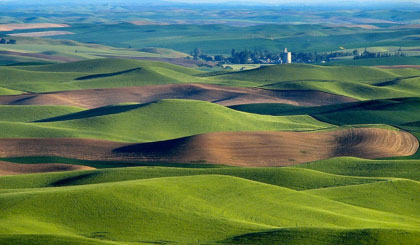
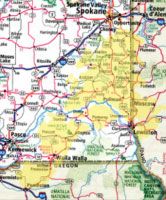
To get to Lewiston, I first flew into Spokane, WA with all its Ponderosa pine trees, and then I had to drive two hours southeast. Just a short distance south of Spokane the Ponderosa trees stopped and I came into what for me was a fascinating geological part of the country, the Palouse Hills. It reminded me of the sand dunes of the Middle East, except it was not sand, but rather a very fertile, mostly wheat growing agricultural area.

The Palouse Hills in SE Washington State

Geologists believe a flood of unprecedented proportions took place 18,000 to 20,000 years ago during the Great Ice Age and carved out what is known as the Channeled Scablands. The Spokane Flood left its mark by unearthing a giant lava flow along a course of more than 550 miles, extending from western Montana to the Pacific Ocean.
A cover of windblown silt or loess began to accumulate over much of the exposed lava field, eventually producing the silt dunes with their random humps and hollows and the fertile soils of the Palouse Hill country of southeastern Washington and the border region of northern Idaho. The source of the silt was the western part of the lava field where temporary lakes had formed during the flooding. The loess attained a thickness as deep as 200 feet and displays a distinctive rolling surface, reminiscent of desert sand dunes. Wheat is the predominate crop grown in the region.

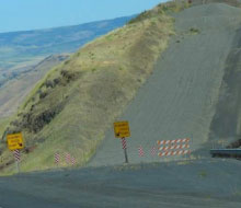
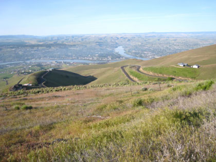
The most amazing part of the drive is when you get within a few miles of Lewiston. Suddenly you are at the edge of the Palouse region and you descend 1,900 feet down the Lewiston Hill in just 5 miles on US 95 to the confluence of the Clearwater and Snake River where Lewiston, ID and adjoining Clarkston, WA are located. The road drops at an average of a 7% grade. There are five "runaway truck ramps" filled with gravel to stop trucks that have brake failure on the steep grade. A number of scenic overlooks have spectacular views of Lewiston and adjoining Clarkston and the Snake and Clearwater Rivers.

View of the Snake and Clearwater Rivers and Lewiston to the left and Clarkston on the right from a scenic overlook as you descend 1,900 feet on US 95 from the Palouse Hills.
Because of dams (and their locks) on the Snake and Columbia River, Lewiston is reachable by some ocean-going vessels. The Port of Lewiston (Idaho's only seaport) has the distinction of being the farthest inland port east of the West Coast of the United States.
We have a number of informative and insightful articles for you in this issue, including our continuing coverage of the impact of digital technology on the competitive entertainment landscape. I hope you enjoy reading them.

Vol. XIV, No. 4, May 2014
- Editor's travelogue
- Do you really know who your competition is? - Part 2
- The different generations
- We're a Foodie Nation
- Early bird discount ends in 12 days
- A nascent trend - entertainment + restaurant + bar = third place social
- Births down, but don't despair
- The folly of not meeting the rising expectation for food sophistication and healthfulness


